
Mon-Fri from 09:00 to 18:00
Sat-Sun - days off

Completed work on geodesy

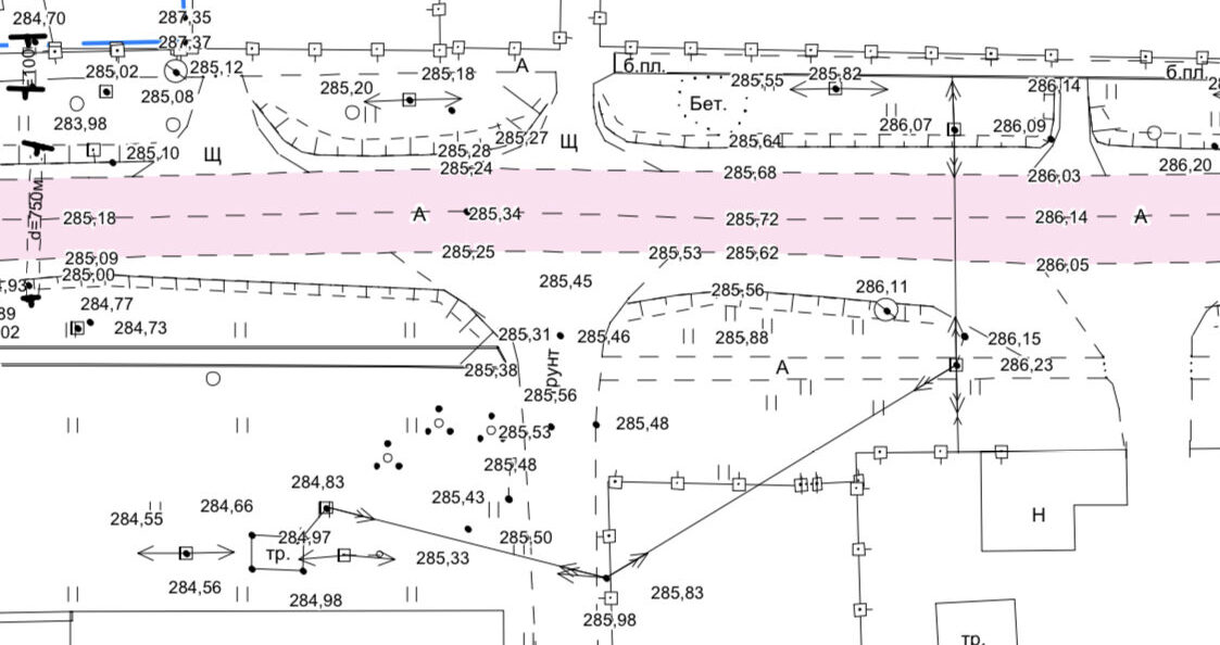
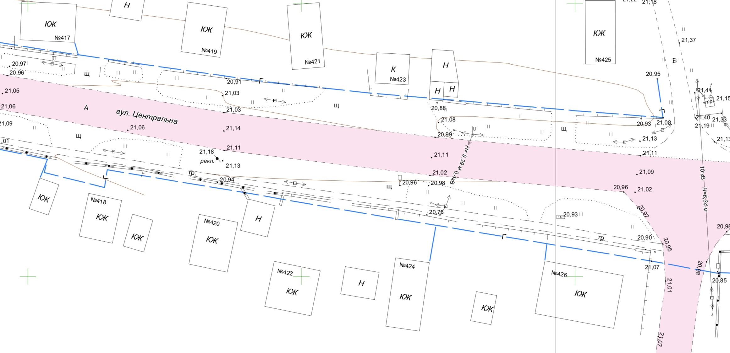
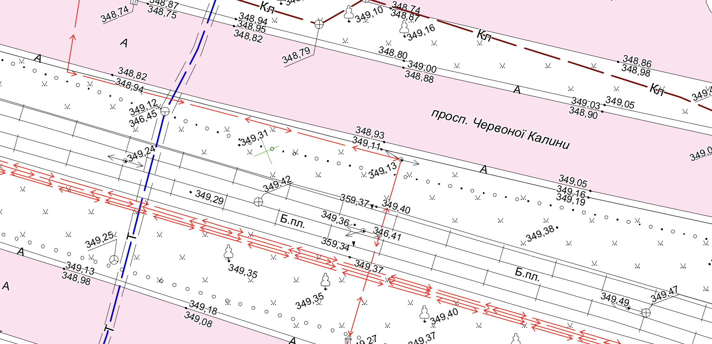
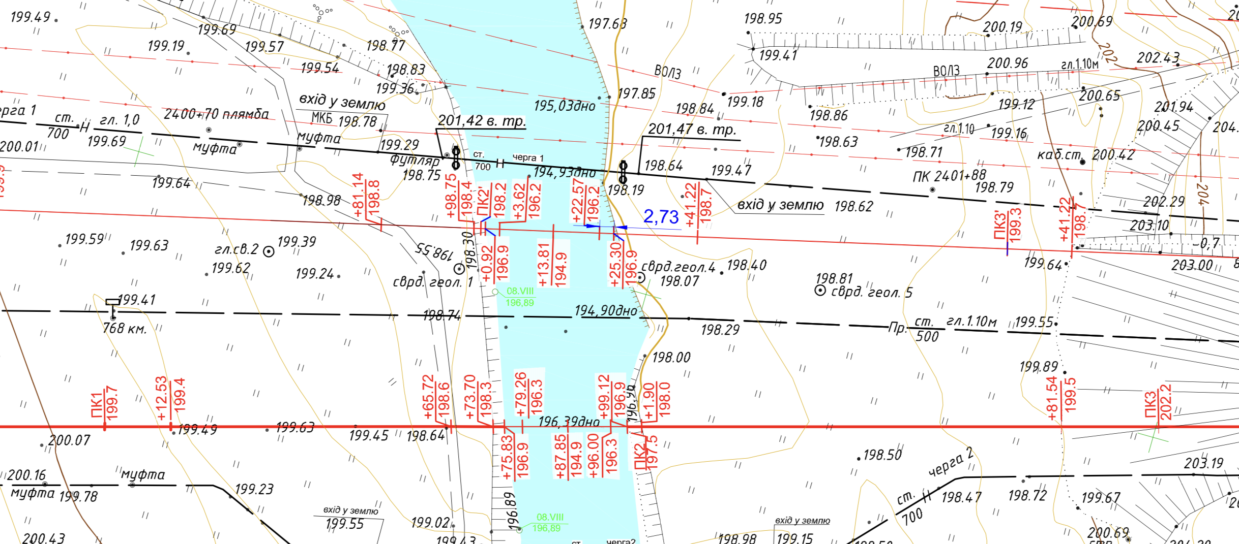
Road P-47, Kherson–Nova Kakhovka–Henichesk
Exploration Objectives
Current average road maintenance.
Geodesy
Topographic survey at a scale of 1:500 (138 km), surveying of surface and underground utilities, measurement of diameters of water pipes and sagging of power cables.
Execution Term:
- fieldwork – 35 days;
- desk work – 30 days.


Road T-23-10, Holosiv–Derazhnia–Luka Barska
Exploration Objectives
Current average road maintenance.
Geodesy
Topographic survey at a scale of 1:1000 (41.376 km), surveying of surface and underground utilities, measurement of diameters of water pipes and sagging of power cables.
Execution Term:
- fieldwork – 14 days;
- desk work – 12 days.

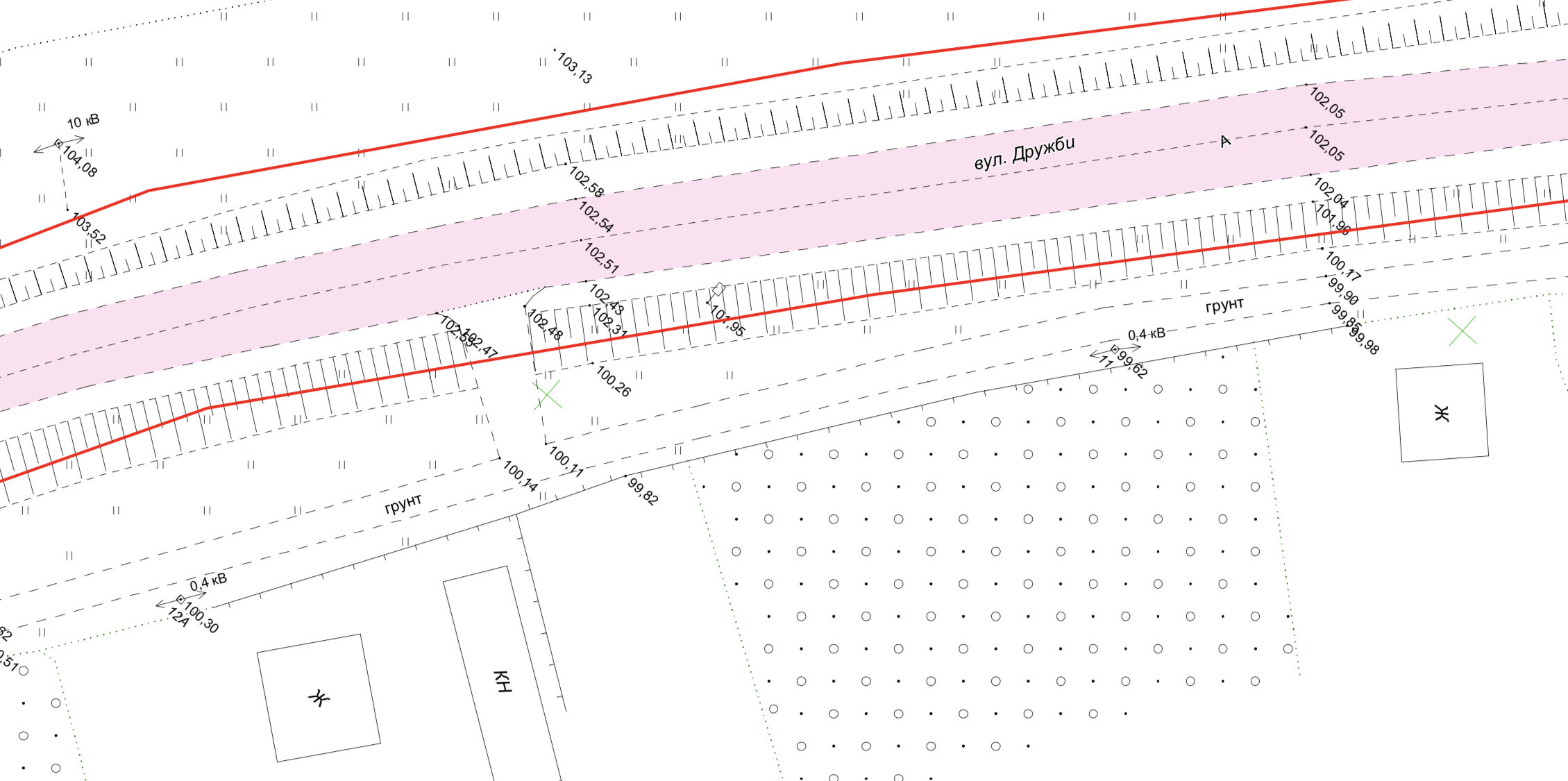
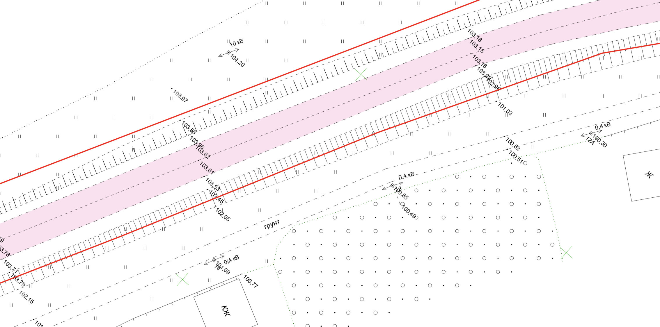
Road T-13-07, Svatove - Novopskov - Milove
Exploration Objectives
Current average road maintenance.
Geodesy
Topographic survey at a scale of 1:1000 (24.6 km), surveying of surface and underground utilities, measurement of diameters of water pipes and sagging of power cables.
Execution Term:
- fieldwork – 9 days;
- desk work – 10 days.

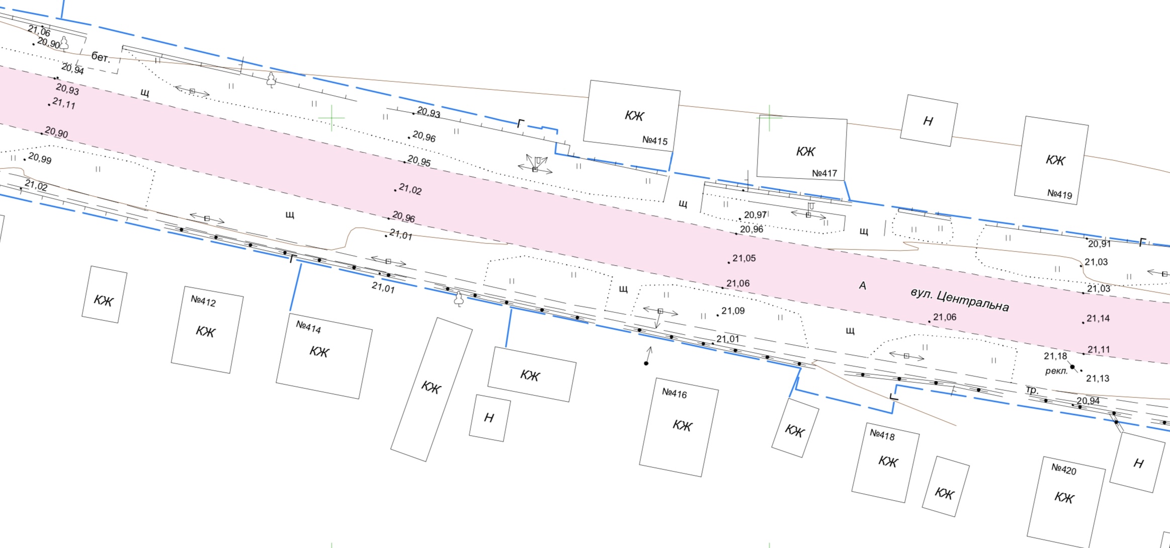
Road R-37, Energodar-Vasylivka
Exploration Objectives
Current average road maintenance.
Geodesy
Topographic survey at a scale of 1:500 (34.4 km), surveying of surface and underground utilities, measurement of diameters of water pipes and sagging of power cables.
Execution Term:
- fieldwork – 10 days;
- desk work – 8 days.
Road H-14, Oleksandrivka-Kropyvnytskyi-Mykolaiv
Exploration Objectives
Current average road maintenance.
Geodesy
Topographic survey at a scale of 1:500 (15 km), surveying of surface and underground utilities, measurement of diameters of water pipes and sagging of power cables.
Execution Term:
- fieldwork – 5 days;
- desk work – 6 days.


Road O26080, Zalishchyky-Zvyniachyn-Horodenka
Search Goals
Current average road maintenance.
Geodesy
Topographic survey at a scale of 1:500 (9 km), surveying of surface and underground utilities, measurements of diameters of water conduits, and sagging of power cables.
Completion Time:
- Fieldwork – 4 days;
- Office work – 3 days.

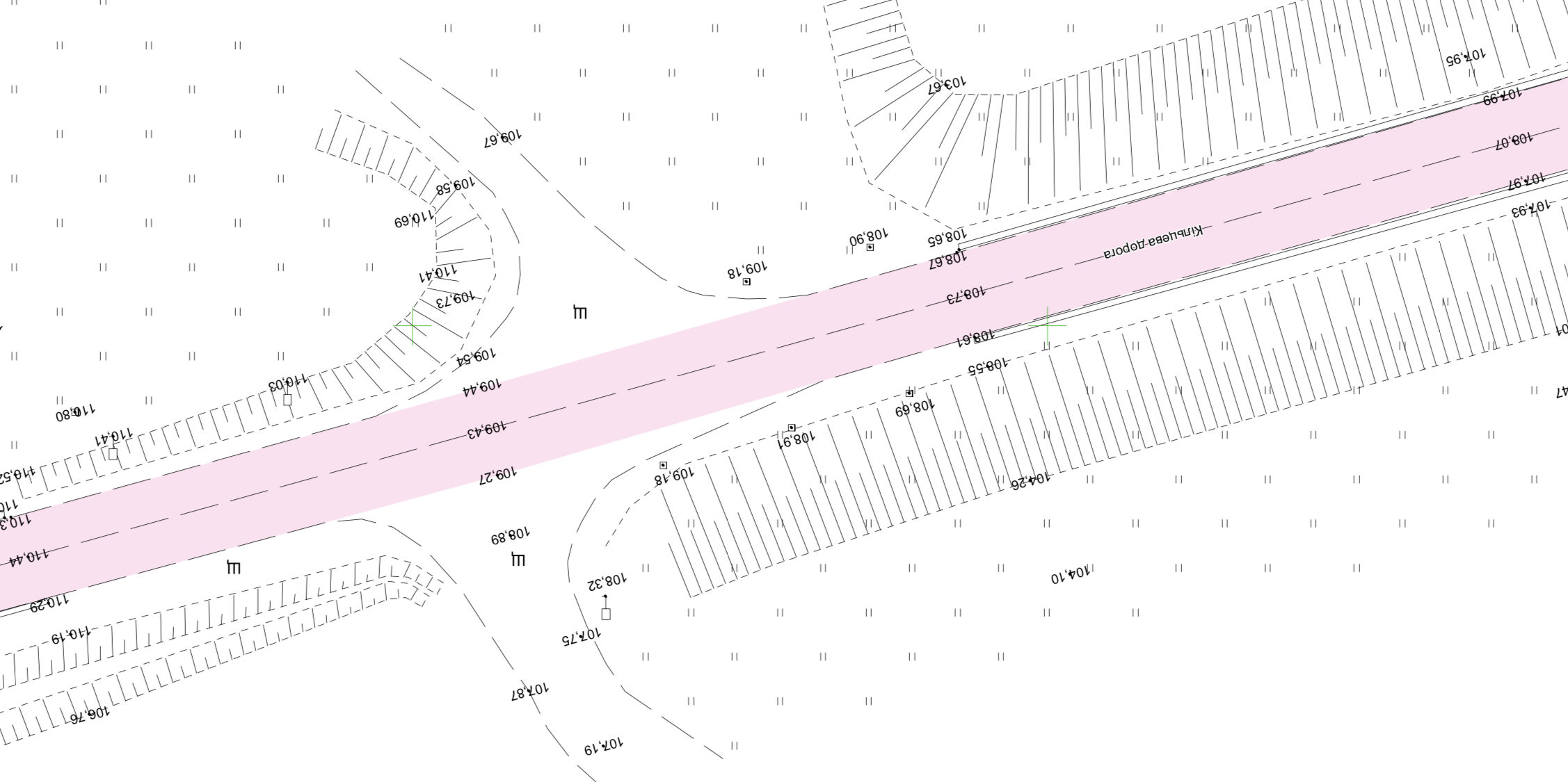
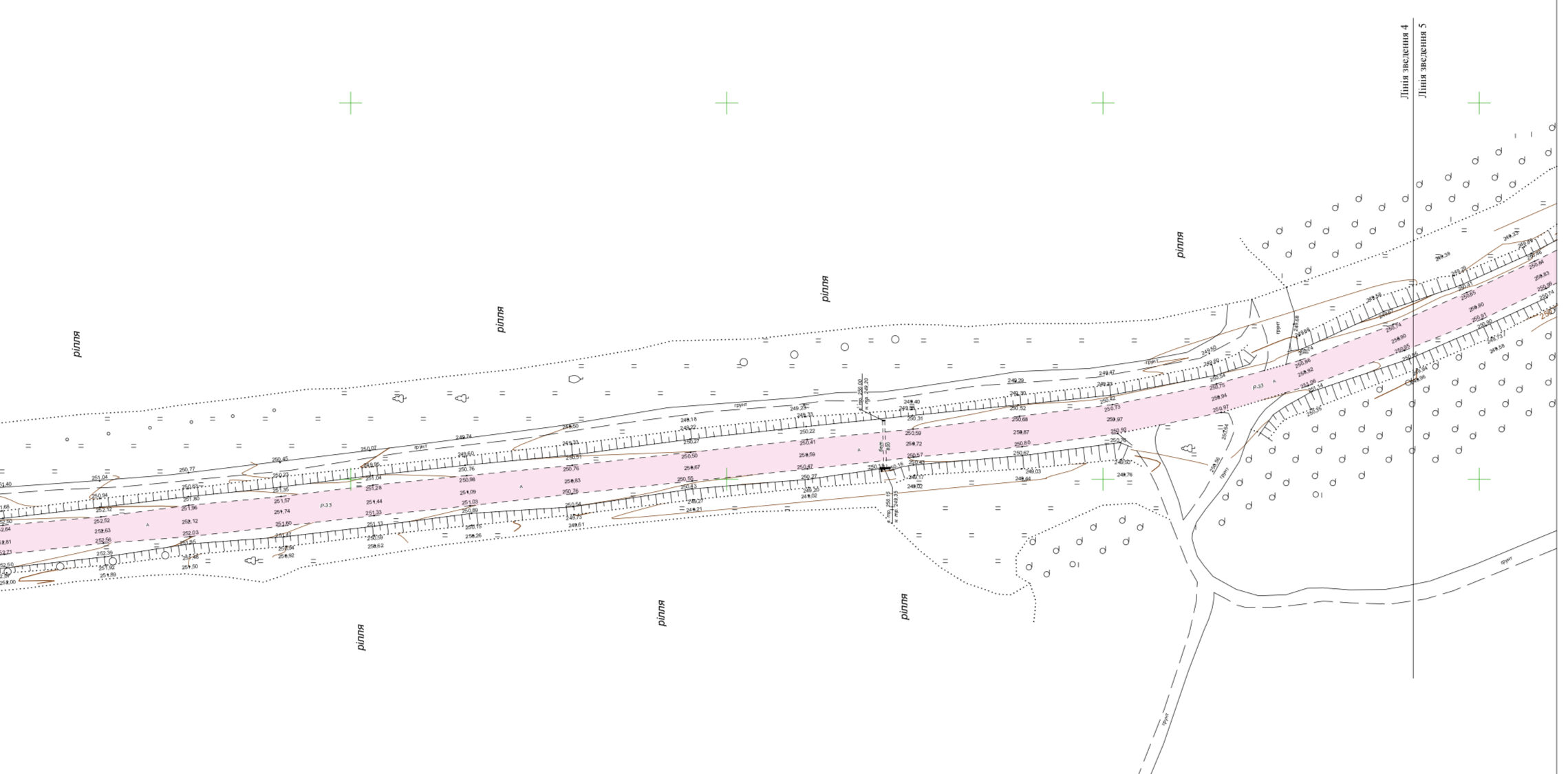
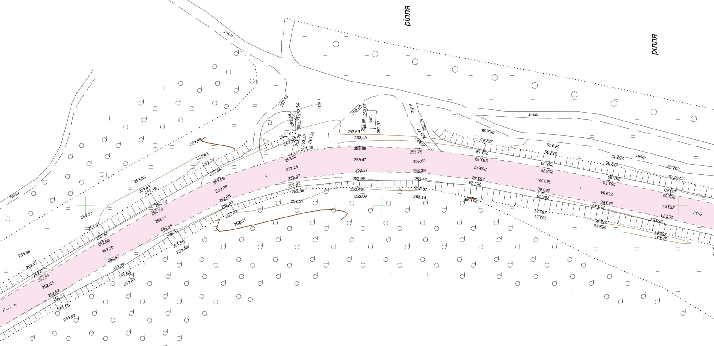
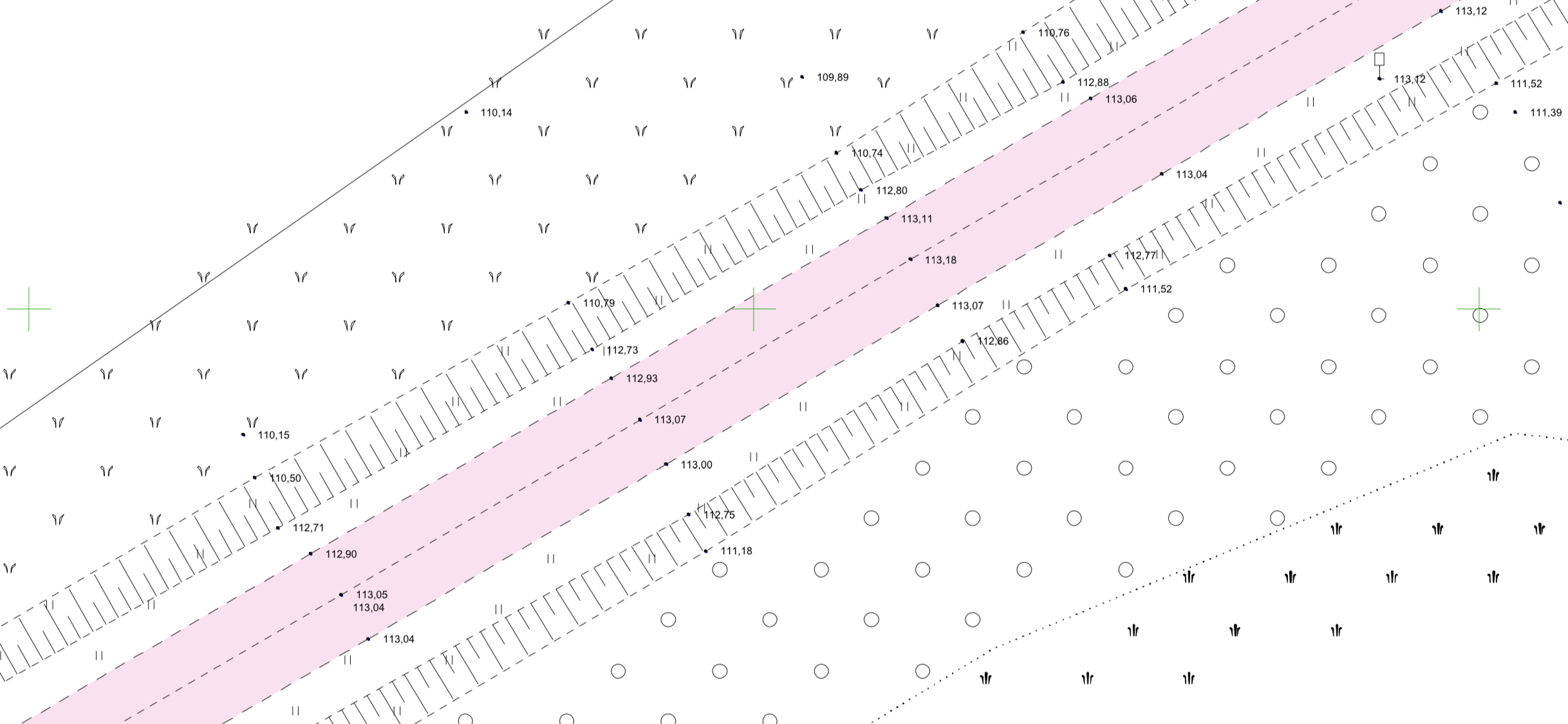
Road P-33, Vinnytsia-Turbiv-Haisyn-Balta-Velyka Mykhailivka
Goals of the Survey
Performing current average road repairs.
Geodesy
Topographic survey at a scale of 1:1000 (17 km), surveying of surface and underground utilities, measuring the diameters of water conduits, and sagging of power lines.
Completion Time:
- Fieldwork – 6 days;
- Office work – 3 days.

Road H-07 "Kyiv-Sumy-Yunakivka"
Goals of the Survey
Current average road maintenance.
Geodesy
Topographic survey at a scale of 1:500 (20 km).
Duration:
- Field work – 7 days;
- Office work – 10 days.

Main water pipeline in Chernivtsi
Objectives of the survey:
Designing the reconstruction of a damaged section of the water pipeline.
Geodesy:
Topographic survey at scales of 1:500 and 1:5000 (42 km).
Термін виконання:
- Fieldwork – 24 days;
- Office work – 17 days.

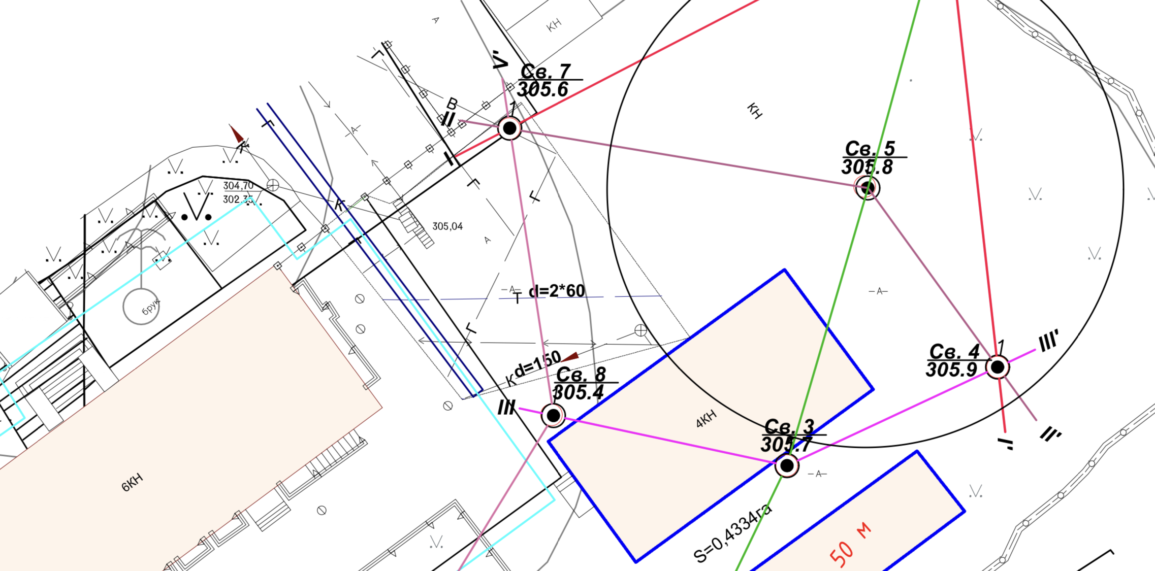
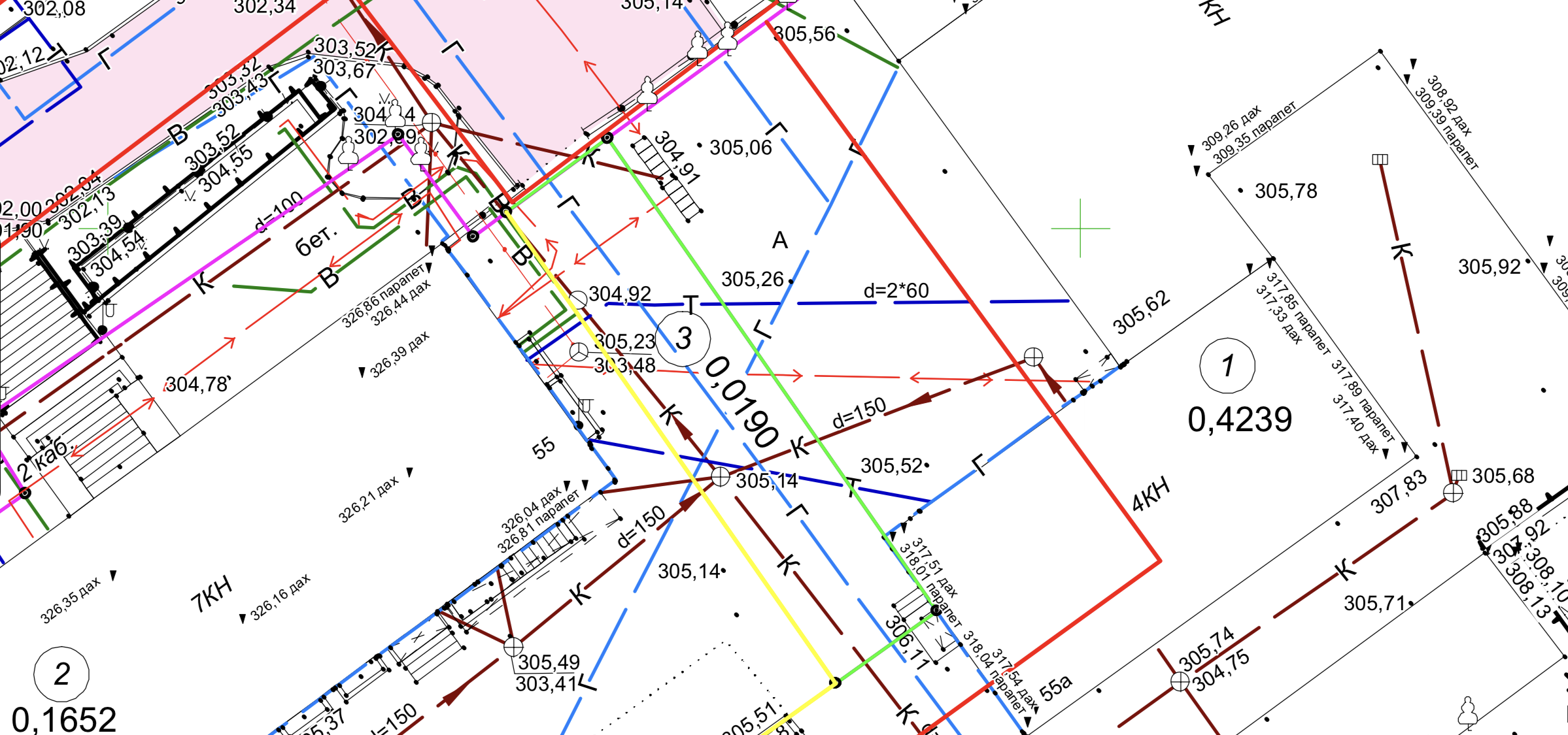
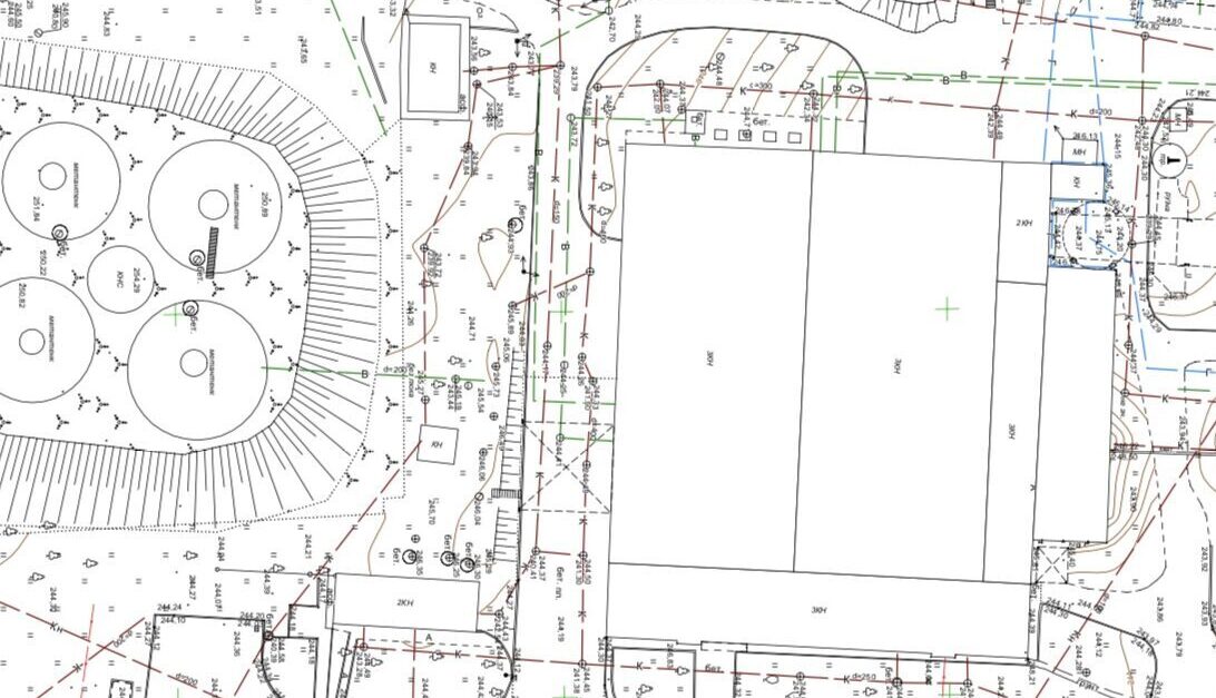
"KES-UA Holding" LLC
Goals of the search:
Designing the construction of industrial, warehouse, auxiliary buildings, and structures.
Geodesy:
Topographic survey at a scale of 1:500 (11 hectares), coordination of the presence of engineering networks, marking of red lines.
Completion time:
- Fieldwork: 12 days;
- Office work: 12 days.

Residential complex 'Avalon' in Lviv
Goals of the survey:
Designing multi-story residential complexes.
Geodesy:
Topographic survey at a scale of 1:500 (1.72 hectares), approval of the presence of engineering networks, marking of red lines.
Completion time:
- Fieldwork – 10 days;
- Office work – 12 days.
Mykolaiv Cement Plant
Goals of the search:
Designing the reconstruction of the cement plant.
Geodesy:
Topographic survey at a scale of 1:500 (4.28 hectares).
Completion time:
- Fieldwork – 10 days;
- Desk work – 12 days.

"Arsen" supermarket in Lviv
Goals of search:
Designing the reconstruction of a supermarket.
Geodesy:
Topographic survey on a scale of 1:500 (5.9 hectares), approval of the presence of engineering networks, drawing red lines.
Completion time:
- Field work – 3 days;
- Chamber works – 4 days.

LLC "Epicenter K"
Goals of the Survey
Designing a shopping center.
Geodesy
Topographic survey at a scale of 1:500 (2.3 hectares), approval of the presence of engineering networks, marking of red lines.
Completion Time:
- Field work – 2 days;
- Office work – 2 days.
Gas station "ANP" in Sambir
Goals of the Survey
Designing a gas station.
Geodesy
Topographic survey at a scale of 1:500 (1.5 hectares), confirmation of the presence of engineering networks.
Completion Time:
- Field work – 1 day;
- Office work – 2 days.
Production and warehouse building in Maly Lyubin
Goals of the Survey
Designing the construction of a new industrial and warehouse building.
Geodesy
Topographic survey at a scale of 1:500 (3 hectares), confirmation of the presence of engineering networks, marking of red lines.
Completion Time:
- Field work – 1 day;
- Office work – 1 day.
Gas station "UPG" in Lviv
Goals of the Survey
To create an executive survey upon completion of construction.
Geodesy
Topographic survey at a scale of 1:500 (1.7 hectares), confirmation of the presence of engineering networks, marking of red lines.
Completion Time:
- Field work – 1 day;
- Office work – 2 days.
Galnaftogaz, Brody
Goals of the Survey
For construction permit.
Geodesy
Topographic survey at a scale of 1:500 (21 hectares), confirmation of the presence of engineering networks, marking of red lines.
Completion Time:
- Field work – 1 day;
- Office work – 3 days.
Galnaftogaz, Halych
Goals of the Survey
For construction permit.
Geodesy
Topographic survey at a scale of 1:500 (22 hectares), confirmation of the presence of engineering networks, marking of red lines.
Completion Time:
- Field work – 2 days;
- Office work – 4 days.


Galnaftogaz, Hrebinky
Goals of the Survey
For construction permit.
Geodesy
Topographic survey at a scale of 1:500 (20 hectares), confirmation of the presence of engineering networks, marking of red lines.
Completion Time:
- Field work – 2 days;
- Office work – 4 days.
Galnaftogaz, Lviv
Goals of the Survey
For construction permit.
Geodesy
Topographic survey at a scale of 1:500 (30 hectares), confirmation of the presence of engineering networks, marking of red lines.
Completion Time:
- Field work – 2 days;
- Office work – 3 days.


Galnaftogaz, Uzhhorod
Goals of the Survey
For construction permit.
Geodesy
Topographic survey at a scale of 1:500 (21 hectares), confirmation of the presence of engineering networks, marking of red lines.
Completion Time:
- Field work – 2 days;
- Office work – 4 days.

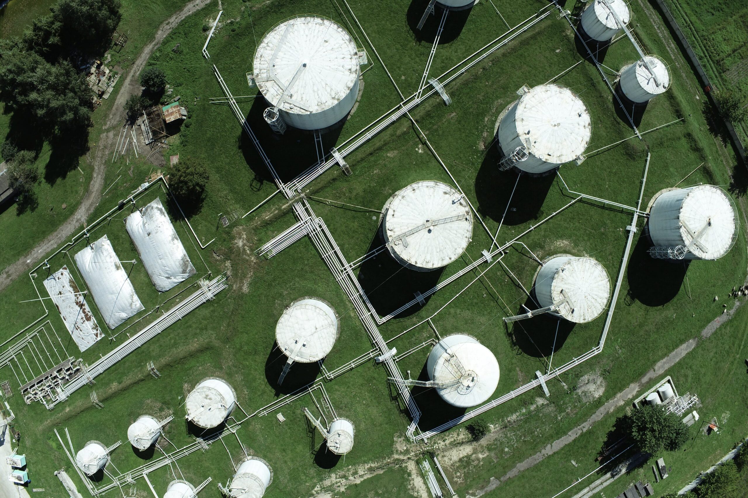
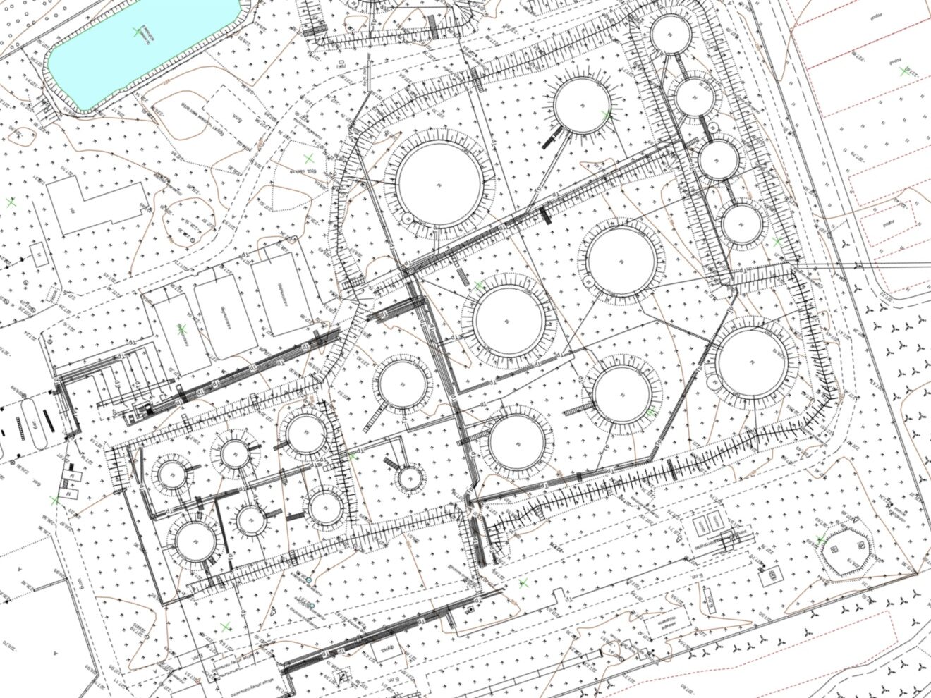
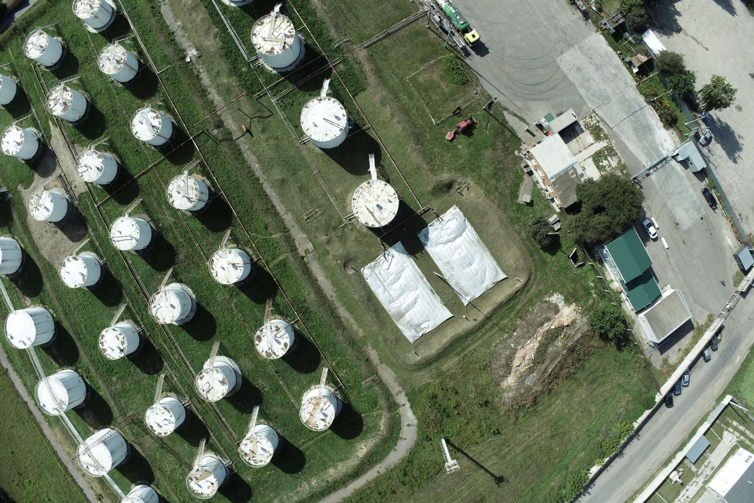
Oil pipelines Pechyvody
Goals of the Survey
For the reconstruction of the main oil pipeline “Druzhba”.
Geodesy
Topographic survey at a scale of 1:1000 (28 hectares).
Completion Time:
- Field work – 4 days;
- Office work – 5 days.
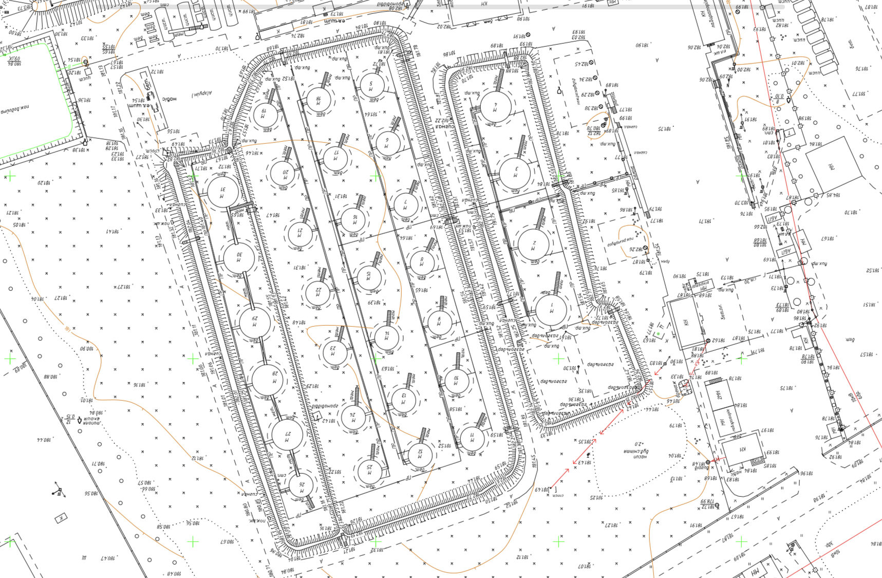
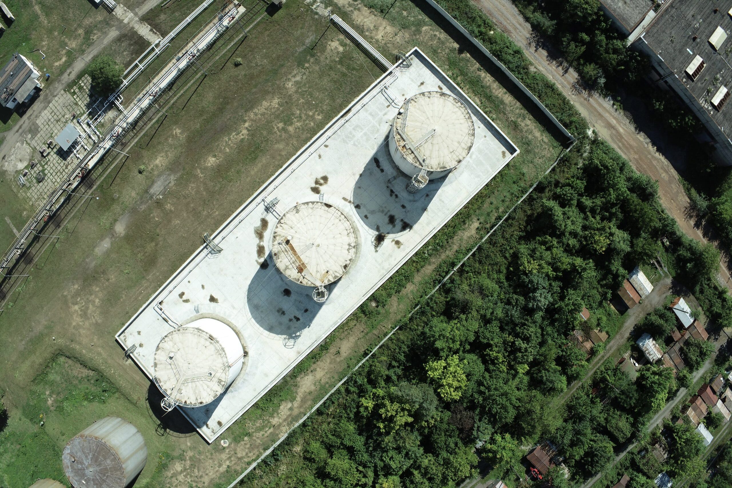
Oil pipelines Pylypovychi
Goals of the Survey
For the reconstruction of pipelines.
Geodesy
Topographic survey at a scale of 1:1000 (15 hectares).
Completion Time:
- Field work – 2 days;
- Office work – 4 days.

Recreation complex "Grand Resort"
Goals of the Survey
For creating the master plan of the “Grand Resort” recreational complex.
Geodesy
Topographic survey at a scale of 1:2000 (18 hectares).
Completion Time:
- Field work – 1 day;
- Office work – 2 days.


PJSC "NPP Interenergo"
Goals of the Survey
For the construction of a biogas plant with combined production of electric and thermal energy in Lviv.
Geodesy
Topographic survey at scales of 1:500 and 1:2000 (18 hectares).
Completion Time:
- Field work – 4 days;
- Office work – 5 days.

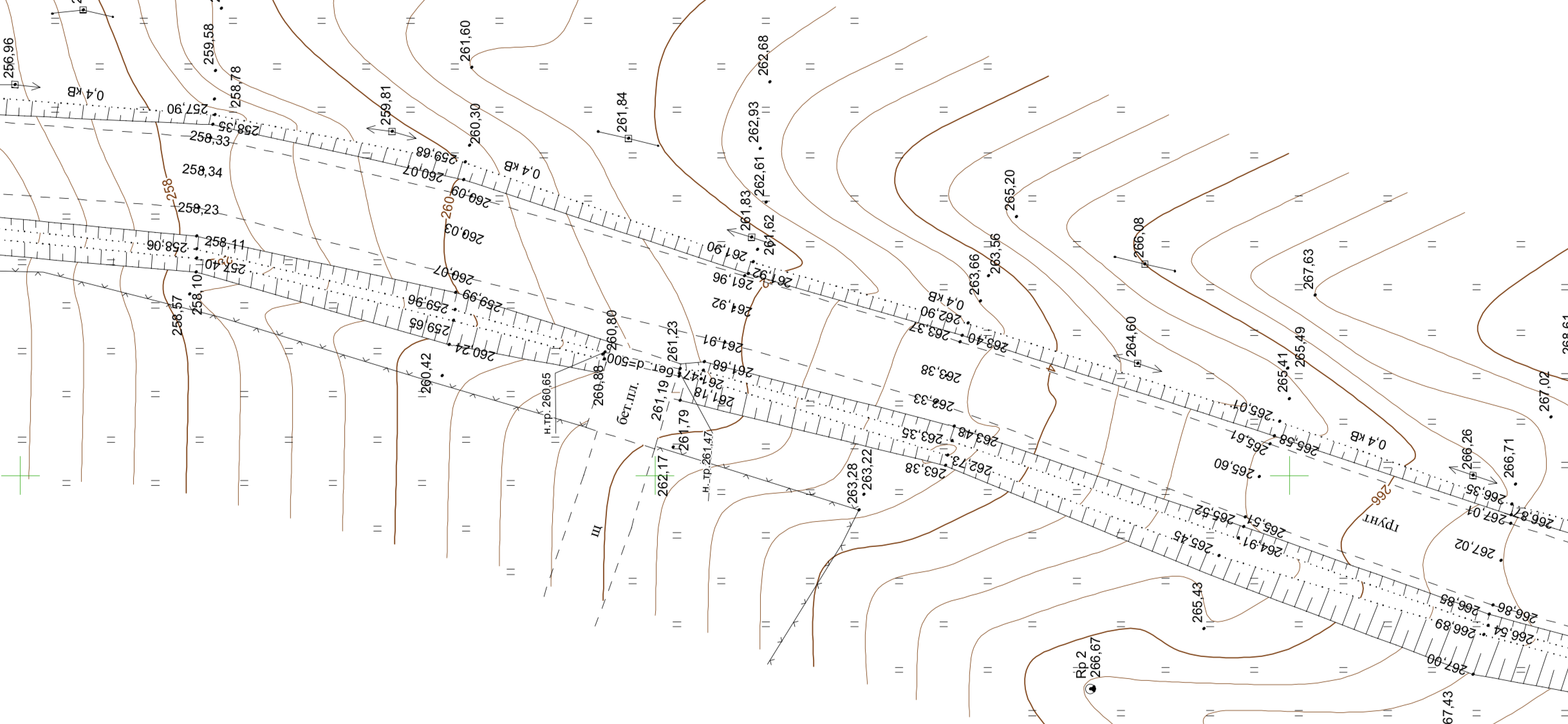
Road T-14-02 "Skhidnytsia - Pisochna"
Goals of the Survey
For the construction of the state-level highway T-14-02 “Skhidnytsia – Pisoschna”.
Geodesy
Topographic survey at a scale of 1:500 (5 km), coordination of engineering network availability, and marking of red lines.
Completion Time:
- Field work – 2 days;
- Office work – 2 days.

JSC "UKRNAFTOKHIMPROEKT"
Goals of the Survey
For comprehensive assessment of natural and man-made conditions of the construction area and for design, construction, and operation of facilities.
Geodesy
Topographic survey at a scale of 1:500 (20 hectares).
Completion Time:
- Field work – 2 days;
- Office work – 4 days.

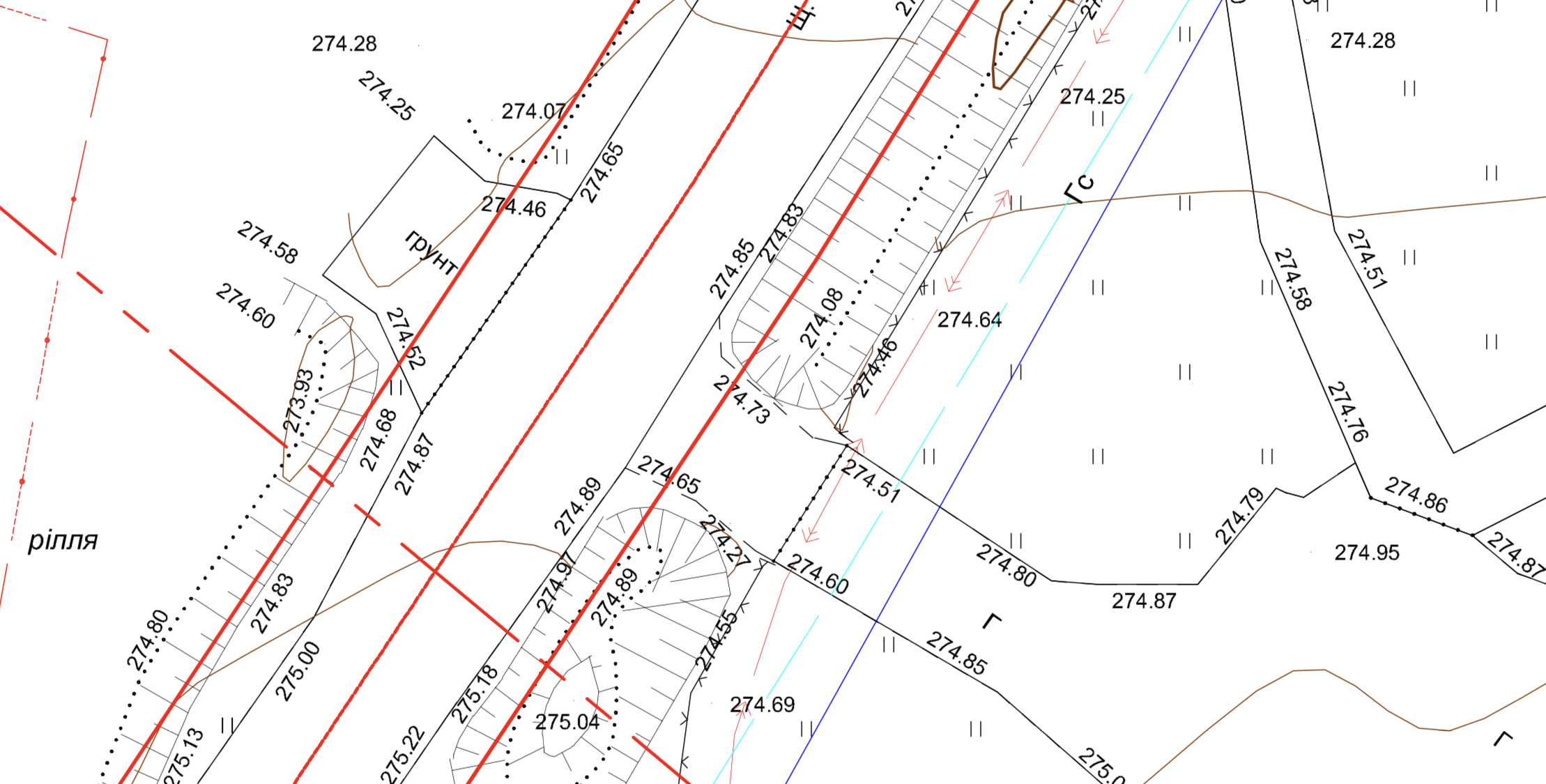
Oil pipeline "Druzhba"
Goals of the Survey
For the reconstruction of the main oil pipeline “Druzhba,” including the relocation of pipeline sections across the Korchak River, Pechivody village, Slavutych district, Khmelnytskyi region.
Geodesy
Topographic survey at a scale of 1:1000 (28 hectares).
Completion Term:
- field work – 1 month;
- office work – 2 months.

Engineering and geodetic searches in the city of Lviv, str. Kukurudzyana
Goals of the Survey
To provide the project organization with initial data.
Geodesy
Topographic survey at a scale of 1:500 (1 hectare).

KNP "1st Territorial Medical Association of Lviv"
Goals of the Survey
For the reconstruction with further extension of the building of the Lviv City Territorial Medical Association No. 1.
Geodesy
Topographic survey at scales of 1:500 and 1:2000.

LLC "NORDIC-BUD"
Goals of the Survey
To provide the project organization with a topographic plan.
Geodesy
Topographic survey at a scale of 1:500 (5.5 hectares).

KST "Teploenergetik"
Goals of the Survey
To create a landscape design.
Geodesy
Topographic survey on a scale of 1:100 (0.371 ha).

«Substation 330kV «Rivne»
Goals of the Survey
Obtaining data to ensure territorial planning in the scope,
necessary for the development of the working project for the reconstruction of the 330 kV substation “Rivne” from
construction of protective structures of the main equipment, reception of the constructed ones
objects into operation.
Geodesy
Topographic survey on a scale of 1:200 (2 hectares).

Oil pipeline "Brody-Derzhkordon"
Goals of the Survey
To provide the project organization with a topographic plan for the purpose of dismantling the DN500 and DN700 oil pipelines at the Brody-Derzhkordon section km232-km286 of the Druzhba MN.
Geodesy
Topographic survey on a scale of 1:500 (214 hectares)


LLC "NORDIC-BUD"
Goals of the Survey
To ensure the project organization with a topographic plan for the arrangement of well No. 13 Rudnykivska with connection to the gas pipeline-loop from well No. 17 Rudnykivska (reconstruction) on the territory of Rozvadivska rural TG Stryi district of Lviv region.
Geodesy
Topographic survey on a scale of 1:500 (5.5 km).

© Copyright - mirnychyj. All rights reserved!
Website promotion -

Our contacts
Contact us conveniently


Leave a request
and we will contact you
